A web-based geospatial tool that identifies functional urban regions by clustering OpenStreetMap Points of Interest. It reveals how cities are actually used and experienced by people, rather than how they are administratively divided.
A web-based geospatial tool that identifies functional urban regions by clustering OpenStreetMap Points of Interest. It reveals how cities are actually used and experienced by people, rather than how they are administratively divided.
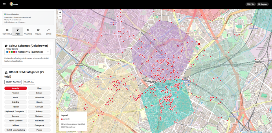
Traditional mapping shows administrative boundaries and physical infrastructure, but PlaceCrafter uncovers the human geography of cities. By analysing clusters of cafés, museums, shops, and other points of interest, it identifies platial regions, functional areas that emerge from everyday human activity patterns.
Real-time POI analysis with multiple clustering algorithms
Platial boundaries based on human activity patterns
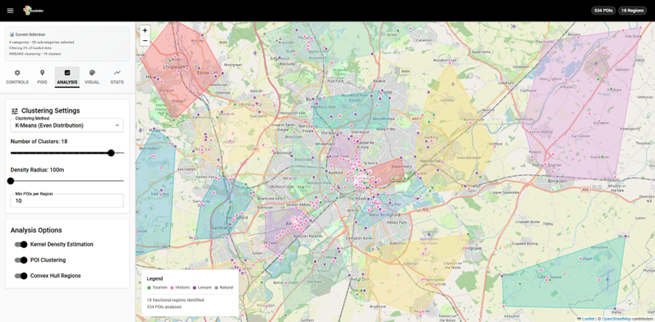
PlaceCrafter provides a comprehensive suite of tools for analysing and visualising functional urban regions through OpenStreetMap data.
K-means, DBSCAN, and hierarchical algorithms for identifying functional regions
Filter by POI categories: tourism, leisure, commercial, historical, and more
Spatial autocorrelation and cluster coherence metrics for quality assessment
Multiple boundary rendering options with interactive mapping interface
Export results for further analysis in GIS software
Live OpenStreetMap data via Overpass API for up-to-date analysis
Modern, type-safe web development with Vite
Interactive mapping with advanced spatial operations
Dynamic, interactive data visualisation
Real-time OpenStreetMap data access
Get started with PlaceCrafter in just a few simple steps. The application runs in your web browser with only Node.js required.
                                    git clone https://github.com/jwilliamsresearch/place-crafter

                                    cd place-crafter

                                    npm install

                                    npm run dev
PlaceCrafter is open-source software released under the MIT License. If you use PlaceCrafter in your research, please cite the launch paper.
                                    @inproceedings{williams2025placecrafter,

                                      title={PlaceCrafter: Curating Urban Functional Regions through Platial Clustering of OpenStreetMap Points of Interest},

                                      author={Williams, James and Priestnall, Gary},

                                      booktitle={Proceedings of the OSMScience 2025},

                                      year={2025},

                                      address={Manila, Philippines}

                                    }
PlaceCrafter is free and open-source software. You are free to use, modify, and distribute this software for any purpose, including commercial use, under the terms of the MIT License.